
Dubai’s New Addressing System: What the Rollout Means for Homes and Businesses
Dubai’s enhanced addressing system will cover 186 areas, helping residents and businesses identify locations as the city’s communities grow.
Dubai is introducing a clearer and more connected way to identify its areas, streets and properties as the city continues to grow.
According to the official announcement from Dubai’s Roads and Transport Authority, the Supreme Committee for Urban Planning, in coordination with RTA and Dubai Municipality, has launched a new visual identity and enhanced addressing system for areas across Dubai.
A Phased Rollout Across Dubai’s Communities
The project will cover 186 areas across 19 sectors. Its phased implementation is planned to begin in the fourth quarter of 2026 and continue until 2030.
Street Signs and House Numbers
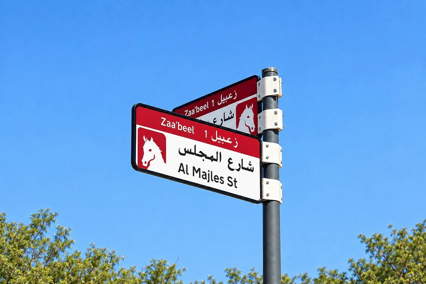
The new system will include area identification signs, internal street-name signs and house-number plates. These elements will follow unified designs intended to make locations easier to identify while giving different parts of Dubai their own visual character.
Five colours will reflect the geographic features of different areas. Blue will represent areas near the sea, while gold will be used for locations shaped by a desert environment.
The First Areas in the Programme
The first phase is expected to include the installation or replacement of more than 2,000 signs across Za’abeel 1, Za’abeel 2, Nad Al Sheba, Al Khawaneej 1 and Nazwa.
QR codes will provide information about sectors, areas, street names and nearby points of interest. Future stages are planned to extend the system to bus stops, digital applications and area maps.
What Clearer Addresses Mean for Homes and Businesses
For residents, clearer street names and house numbers may make it easier to explain and find an address. For businesses, the system may support more organised journeys for customers, service providers and deliveries. Its full effect will depend on the rollout in each area and how the system is integrated with digital navigation tools.
The initiative also reflects the importance of identity within urban planning. As Dubai expands, each community needs to be easy to recognise and navigate while remaining part of a connected city.
Reading a Property’s Wider Location
Location and accessibility are important when exploring a place to live. The Prestige One Destinations section introduces the Dubai communities where the company’s developments are located, helping buyers understand the wider setting surrounding each address.
For example, readers can explore Jumeirah Garden City alongside FAUCHON Résidences by Prestige One. This is neighbourhood context, not a claim that the project is included in the addressing programme’s first phase.
Our article on why location matters when choosing a property offers further questions to consider, while our New Fourth Corridor news covers a separate part of Dubai’s transport planning.
A Long-Term Urban Planning Initiative
The new addressing system should not be treated as a guarantee of higher property prices or stronger investment performance. Property decisions continue to depend on the individual development, location, quality, supply and wider market conditions.
Dubai’s new addressing system is more than a change to street signs. It is part of a long-term plan to make the city’s communities clearer, more accessible and easier to understand as urban growth continues.
Published 12 October 2026. Featured image supplied with RTA’s official announcement; image credit: Roads and Transport Authority.
More stories

Discover what comes next
Explore our developments or speak with our team for more information.